
Assedjefar Fm
Type Locality and Naming
The type locality was designated by Collomb (1962) 80 km west of Awaynat Wanin in the Adrar Uan Assedjefar Hill (28°30′N, 11°30′E). It was defined by Lelubre (1952b) as a sequence of deltaic and shallow marine rocks conformably overlying the Marar Fm in the Hamadat Tanghirt area of west Libya.
References: Lelubre, 1952b; Plauchut & Faure, 1959; Collomb, 1962; Jacqué, 1963; De Rouvre, 1984; Lababidi et al., 1985; Mergl et al., 2001; Fabre, 2005; Tawadros, 2011; Shalbak, 2015; Hallett, 2002, 2016.
Lithology and Thickness
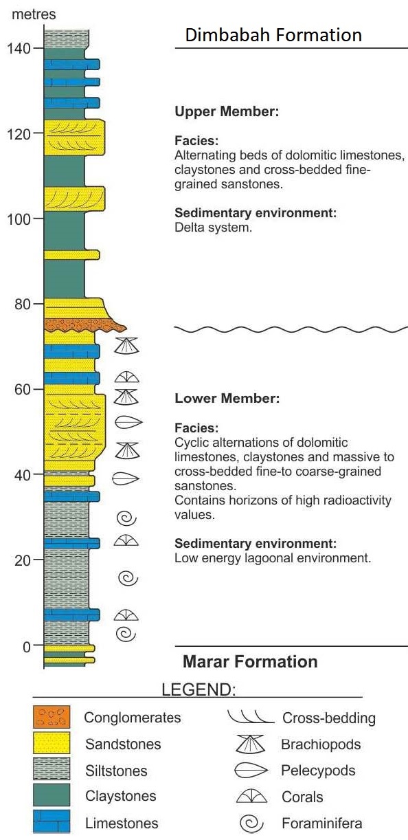
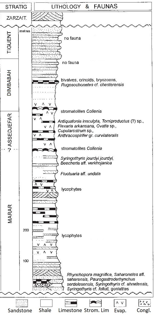
Made up of green shales, often with gypsum beds alternating with calcareous levels. Its thickness is 140 m at the Type Locality (Fig. 1; Fig. 2; Fig. 3). Its thickness is 160 m in the Djado (Fabre (2005), thinning southward to 60 m.
[Figure 1: Stratigraphic column of the Assedjefar Formation at the Type Locality in Libya (Source: Shalbak, 2015)]
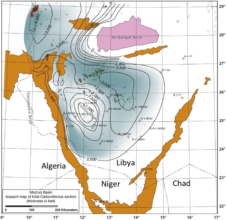
[Figure 2: Isopach map of the Assedjefar Formation]
[Figure 3: Lithostratigraphic column of the Assedjefar Formation]
Relationships and Distribution
Lower contact
Conformable onto the Marar Fm
Upper contact
Overlying unit is the Dimbabah Fm
Regional extent
Djado Basin
GeoJSON
Fossils
The restricted marine to lacustrine environment is indicated by algal stromatolites and concretionary limestones ("Collenia" horizons and Caliche layers). The sequence contains a rich marine fauna of brachiopods (characterized by the large syringothyrid Syringothyris jourdyi and the terebratulid Beecheria, as well as Streptorhynchus, the productids Antiquatonia, Flexaria, Ovatia, Rhipidomella, Composita, Syringothyris, Anthracospirifer and small rhynchonellids), pelecypods, corals and foraminifera plus abundant silicified wood.
Age
Depositional setting
It represents a low-energy lagoonal to shallow shelf environment where dolomitic limestones, siltstones and ferruginous and gypsiferous sandstones were deposited. These facies indicate a retreat of the sea.
Additional Information